Geozone Headerbild

Geofencing


Geofencing in telematics is an advanced technology that has a wide range of applications. It is a method of defining specific geographical areas and creating a virtual boundary that can be monitored. It allows companies to monitor specific areas where their employees work and improve efficiency and safety.

Benefits

  • Easy overview of geo-fences
  • Billing of services
  • Find objects quickly and easily

Request demo


Evaluation of zones

Get accurate data on locations, trips, and activities in geozones.

Proof of services

Manage and document services simply and effectively.

Individually configurable

Customize geozones and design them according to your wishes.


Optimized Zone Analysis

Our detailed zone analysis provides a precise look into the time spent within each geofence zone. It accurately captures how often an employee or vehicle enters a specific zone, and measures the duration for switching between different zones. This essential data allows for significant optimization of your team's scheduling and your fleet's route planning. Use this information to minimize downtime, streamline processes, and ultimately reduce your operational costs significantly.


Billing of services

The billing of services with the help of geofencing is based on the collection of GPS data to determine the actual time spent working in a specific geo-fence zone.

The data generated by the built-in telematics hardware include the exact duration of stay in each zone, the number of visits, or the distance travelled.

In addition, it can greatly simplify the management of billing and reduce the possibility of errors.


Grouping zones

Grouping zones allows you to organise and manage your sites, customers or projects efficiently. For example, construction companies can quickly and easily add new construction sites and group zones together.
The zones can be created in different zone types: circular, polygonal, as a corridor or self-drawn

Zone types

Zone als Kreis anlegen

Circle

Circular geozones are particularly suitable for sites that are concentrated on a specific point or building.

Polygone Zonen einstellen in Software

Polygon

Polygon geozones are particularly suitable for areas such as car parks, warehouses or other areas that are not circular.

Korridor Zone anlegen

Corridor

Corridor geozones are good for businesses that operate along a specific route, such as a road, for example.

Geozonen selber zeichnen

Drawn

Self-drawn geozones can be used, for example, to demarcate specific areas on a construction site or to demarcate a customized area in a park or public space.


Automatic zone import from Open Street Map

The transfer of already created Open Street Map zones into our own software offers many advantages. This allows us to access many already existing geo-fence zones created by other users. This saves you time when creating new zones, and ensures that already established zones can be quickly and easily integrated into our software for your own purposes.


Anti-theft protection through geofence

Geofencing provides effective theft protection by allowing you to define specific geo-fences within which a vehicle, device or other object should be located.

If the object leaves this zone, an alarm is triggered (in our software and on your smartphone) and you can take appropriate action.

By implementing geofencing, the likelihood of theft can be reduced as an alarm is triggered if an object is removed from the predefined area without authorization.

Read more


Exporting geofence evaluations

By a simple click, you can export your created geofences. Exporting geofence evaluations to XLS or CSV files offers numerous benefits. These formats are user-friendly and allow for easy data transfer to other applications. Furthermore, data in these formats can be quickly and easily analyzed. By utilizing this function, you can optimize the performance of your geofencing zones and draw important insights from the data to make informed business decisions.

Types

  • XLS
  • CSV
 

Find objects easily in a zone

With just a few clicks, you can get a list of all objects in the zone and view other information such as location, speed, and timestamp.

This helps you to quickly find out which objects are within a particular zone, giving you better control over your fleet, machines, and assets.

For example, if you are running a construction site, you can use the Object Finder to quickly find out where all your vehicles and machines are and ensure that they are being used effectively.


Our secret of success: Maximum efficiency for your company's success!

We support you from the initial idea through the selection of the right hardware and software components to integration into existing IT systems. Even after implementation, we are at your side with first-class customer support and services. We are proud of the fact that well-known companies from various industries place their trust in us. Put yours in us and make an enquiry!

Request demoBack to Overview


FAQ

Who needs telematics and what is the goal of it?

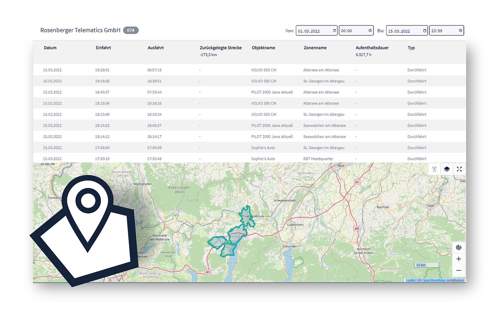
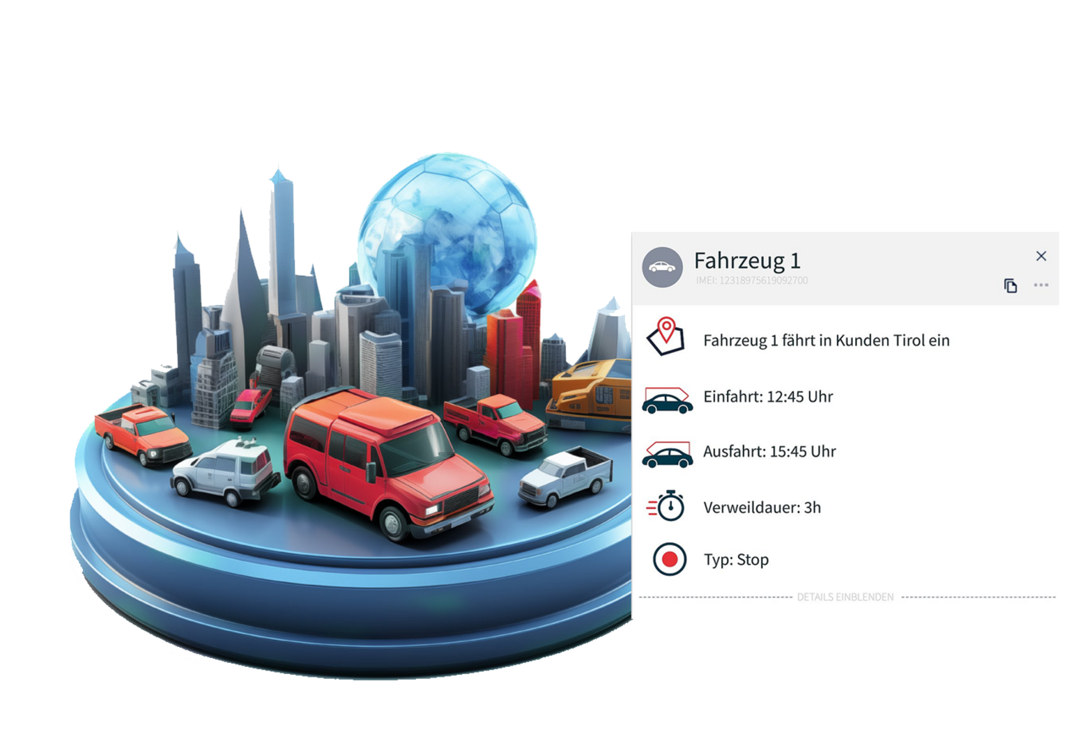
The aim of telematics is to provide the user with position and status data (e.g. engine on/off, speed, tank level, temperature, etc.) and cumulative values (e.g. operating hours, mileage, etc.) from vehicles, machines or other objects as quickly as possible.

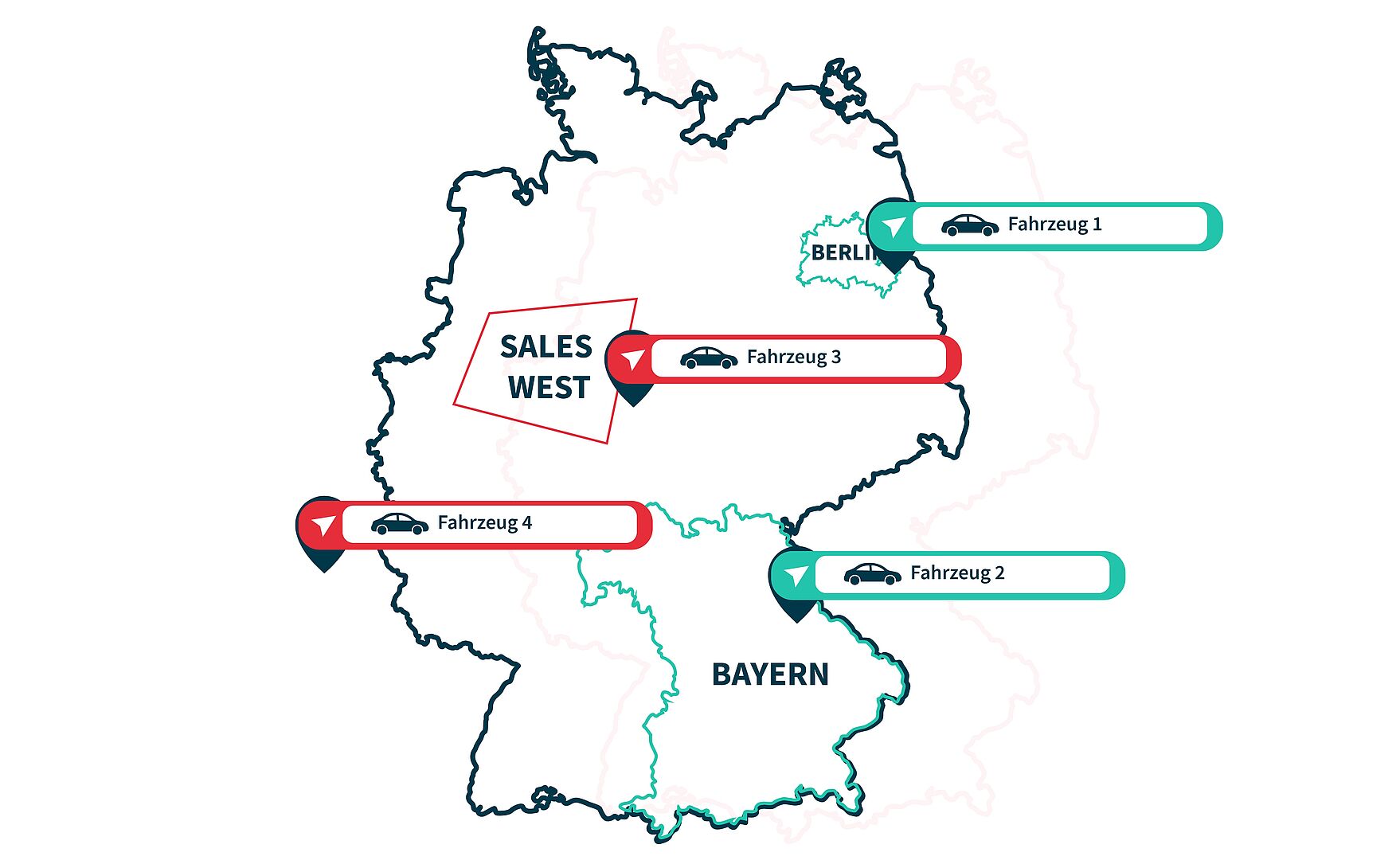
Based on this data, for example, dispatching can be optimized, theft can be detected, and the degree of utilization of a vehicle/machine fleet can be determined. In many cases, the telematics data serves as a basis for decision-making for the acquisition of new equipment, for increasing efficiency, for optimizing maintenance tasks, for reducing insurance rates, etc.

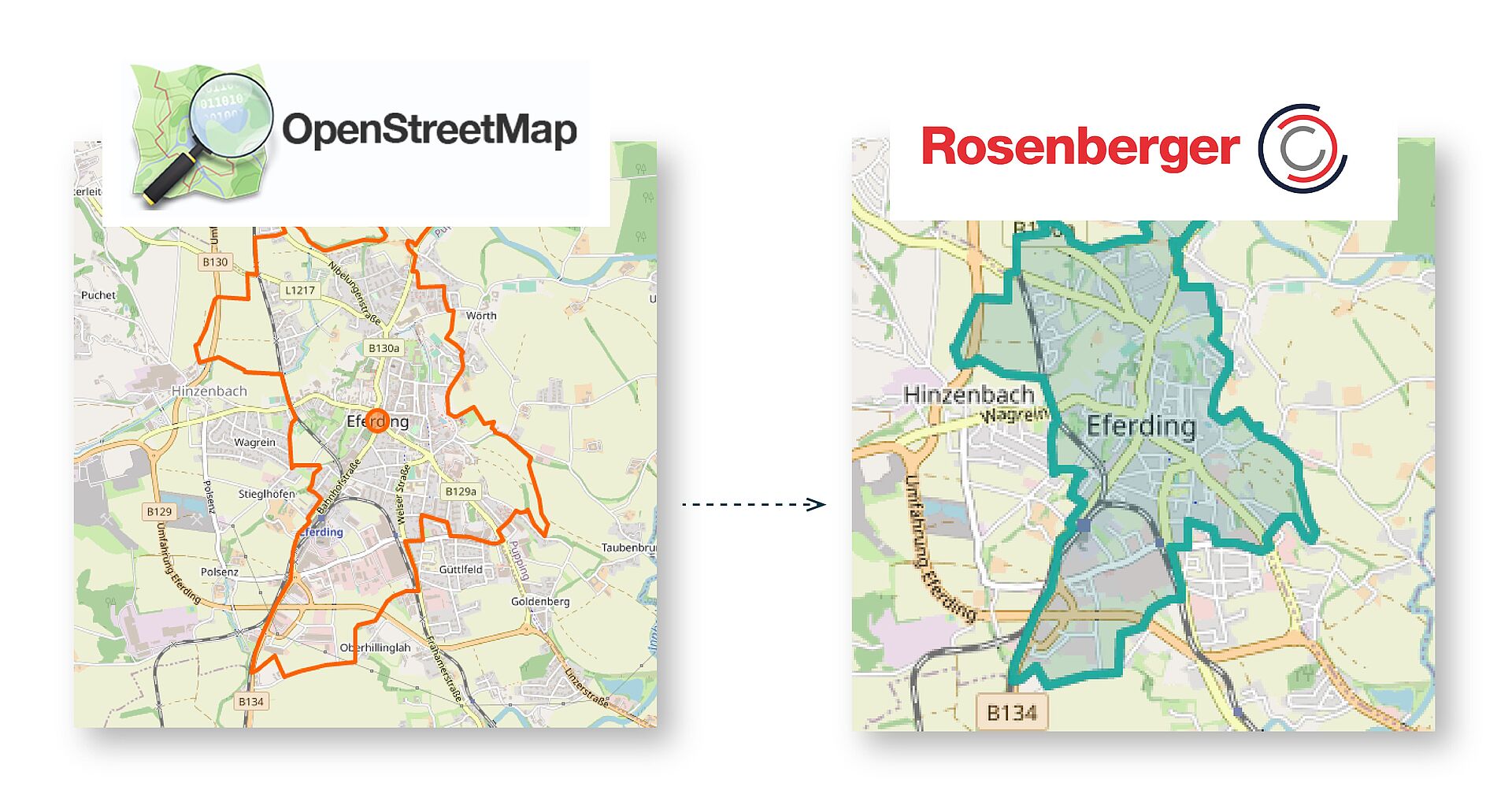
In most cases, an interface (API) for data transfer from the telematics portal to the customer software (EPR systems such as SAP, Microsoft Dynamics, AS400, etc.) is also created.

Together we develop innovative telematics solutions tailored to your needs, which bring many advantages for you:

  • You can reduce your administrative effort
  • Your costs are reduced many times over through the use of telematics units
  • You save time for more value-adding activities
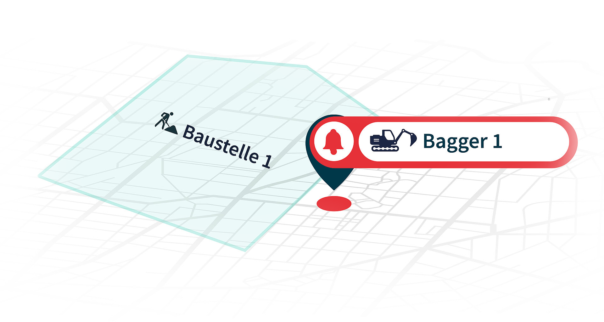
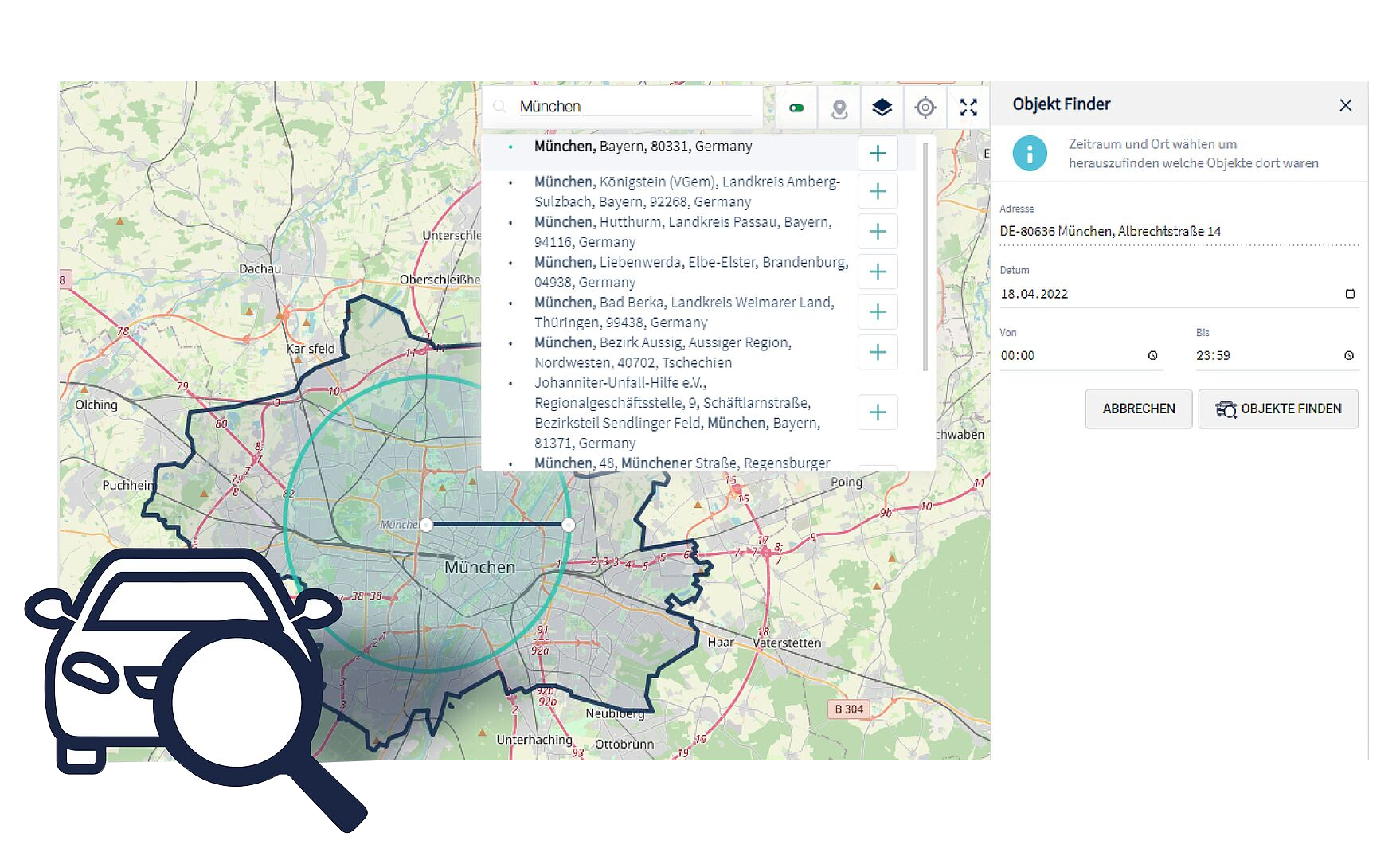
  • Your vehicles, machines, tools can no longer get lost
  • Your fleet of vehicles and machines is efficiently utilized
  • Working with the Rosenberger Commander is easy and understandable
  • Our apps support you with the telematics installation, expansion as well as with the automatic recording of your journeys for the electronic driver's logbook.
  • Telematics is not as expensive as you might think, already from 1 vehicle, 1 machine you will see a return on investment
  • We are a family business, with a global corporation in the background - with us you get handshake quality, with the security to bet on a stable company.
How does telematics work?

A telematics unit (on-board unit) installed in a vehicle or machine transmits information from these objects to a data center using wireless data transmission technology.

In the data center, the information is processed and prepared in such a way that the user can call up all the information relevant to him virtually in real time, but also historically via a web portal. 

How does the telematics app or the telematics portal work?

The data from the telematics units (OBUs) processed in the data center is made available to the user in an easy-to-use and clear web application. All that is required to use the platform is Internet access.

It is not necessary to install the software in the company or on the desktop/laptop. In addition to use via desktop/laptop, a "light" version is also available for mobile use (Rosenberger Drive app or Rosenberger Cockpit app) via tablet or smartphone.


The telematics platform (Rosenberger Commander) has a modular structure and is very intuitive to use. Depending on authorization and role, a variety of modules and reports are available to the user.

A short overview:

  • Live: Real-time information on position and operating status
     
  • History: Chronological display of all signals with graphics, map view and tables
     
  • Zones: Representation of all zones (geofence) stays in a certain period of time, incl. times and covered distances
     
  • Alarms: Overview of all automatically generated alarms and events
     
  • Logbook: Listing of all trips with map information, start, end of trip, addresses, distances, trip type (business, private, way to work), driver as well as trip log report
     
  • Activities: Automatic data analysis of signals over time
     
  • Performance: Comparison of small and large fleets regarding utilization, consumption, etc.
     
  • Status: overview and hit list of all cumulative values like mileage, operating hours, etc.
     
  • Tachograph: all information about the digital tchograph incl. automatic archiving and remote downloading
     
  • Servic: Overview of all maintenance tasks by status (overdue, due soon, not yet due) + reports
     
  • Protocolls: list of all installation, service and removal reports of telematics units (automatically created with the Rosenberger Service App).
     
  • Manage: in this area, all tools for the administration and management of telematics units and objects are available for the administrator
     
  • Organization: here the administrator can manage the users, roles, organizational units within a client, recurring tasks and measured values. 
What is a telematics sensor or OBU (on-board unit)?

A telematics sensor is a data acquisition device that is mounted in vehicles, machines and devices and transmits data from them to a server (data center) for further processing using wireless technology.

The OBU usually consists of a radio module for data transmission, a GPS antenna for position determination, processors for data dissemination and, if necessary, additional digital and analog interfaces for the acquisition of external signals (e.g. temperature, engine signal, pressure, CAN bus, etc.).

Depending on the application Rosenberger offers different housing classes (IP54 to IP76). The antennas (radio module and GPS) can be built into the housing or can be designed as external antennas. The radio modules are available in different versions from 2G (GSM), 3G (UMTS) to 4G (LTE).

What is a telematics tariff?

A telematics rate or license refers to a recurring charge for a telematics unit. At Rosenberger, this fee is usually a flat rate (fixed price). The following services are covered by this tariff:

  • Software license of the telematics portal
  • Data transmission via SIM card (at Rosenberger Europe-wide use)
  • Data processing in the computer center
  • Data storage in the data center (at Rosenberger at least 12 months)
  • Free software updates of the telematics portal (at Rosenberger every 3 weeks)
  • Free webinars 
What information does a telematics unit record?

Which information is recorded depends on the one hand on the telematics hardware used and on the other hand on the signals and sensors available in the vehicle or machine.

For PKWS and light commercial vehicles, for example, the following information is recorded:

  • Time stamp (date and time) of the message 
  • Position incl. address
  • Speed
  • Ignition signal (on/off)
  • Battery voltage of the vehicle
  • Fuel consumption or tank level
  • Etc.


For trucks, for example, the following information is recorded:

  • Time stamp (date and time) of the message 
  • Position incl. address
  • Speed
  • Ignition signal (on/off)
  • Engine signal (on/off)
  • Engine speed
  • Auxiliary drive (on/off)
  • Battery voltage of the vehicle
  • Fuel consumption or tank level
  • Driving and rest times (only with digital tachograph)
  • Working times, breaks and standby times (only with digital tachograph)
  • Remaining driving times (only with digital tachograph)
  • Violations (only with digital tachograph)
  • etc.


For example, the following information is recorded for construction machines:

  • Time stamp (date and time) of the message 
  • Position incl. address
  • Speed
  • Ignition signal (on/off)
  • Engine signal (on/off)
  • load and idle
  • Battery voltage of the vehicle
  • Fuel consumption or tank level
  • For containers and small machines (without power supply to the telematics unit):
  • Time stamp (date and time) of the message 
  • Position incl. address
  • Speed
  • Battery status in %
  • Temperature
     
Is working with you as easy as the man makes it seem like?

In short: Yes!

Together we will develop innovative telematics solutions tailored to your needs that will bring you many benefits.

Just get in touch with us, and we'll create an offer tailored to your needs.

Request now